
WORLD HERITAGE KARST · KHAMMOUANE
Hin Nam No National Park
Hin Nam No Boualapha UNESCO natural heritage
Hin Nam No is the remote eastern edge of Khammouane: 94,121 hectares of limestone towers, forest, caves and underground rivers where a visit is built through village guides rather than a single park gate.
- 01 Leave Thakhek toward Boualapha and the park villages
- 02 Choose a village-based route before entering the landscape
- 03 Walk, boat or cave only with the required local guide
- 04 Let season, water and road conditions decide how deep you go
Treat Hin Nam No as a small expedition, not a Loop roadside stop. One guided trail can fill a day; combining villages, caves and the Xe Bang Fai side is better over several days.
.jpg?width=1600)
FIELD NOTES
THE QUICK READ
Hin Nam No National Park / Laos
TIME
2–4 DAYS FROM THAKHEK
One local trek can take half or full day once you are in the park area
ROUTE
BOUALAPHA · VILLAGE BASES
Remote roads + local guides · no single visitor circuit
BUDGET
GUIDED · VARIABLE
Guide, boat, food and overnight fees depend on the village and route
BEST FOR
WILD KARST + CAVES
Forest · underground rivers · wildlife · community ecotourism
THE SCALE
The park is bigger than any one cave
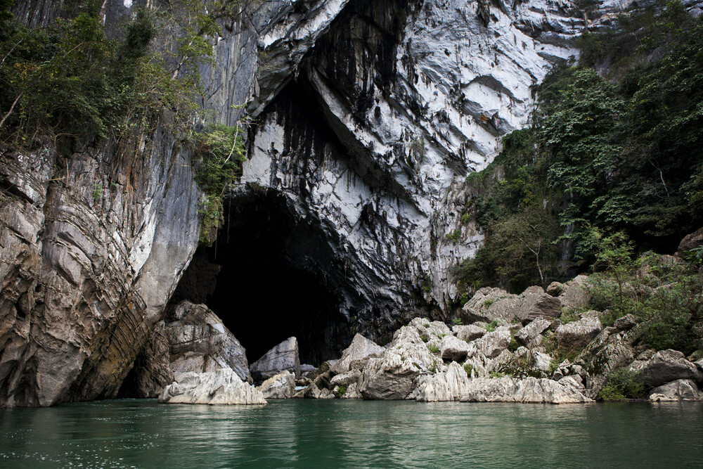
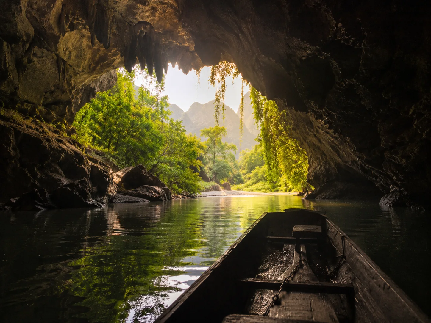
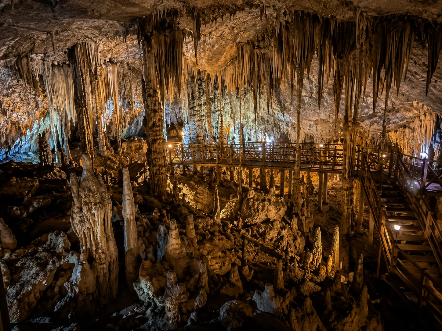
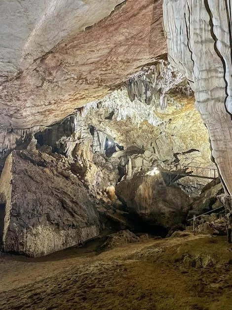
Xe Bang Fai is the name most travellers know, but Hin Nam No is much larger than its famous river cave. UNESCO records 94,121 hectares on the Lao side of the transboundary World Heritage property, with limestone towers, deep depressions, dry and moist forests, caves and underground drainage forming one connected karst system. In 2025 the park was added to neighbouring Phong Nha-Ke Bang in Viet Nam, creating a single World Heritage property across the border. The useful way to read Hin Nam No is therefore as a landscape first: caves are openings into the same geological system that shapes the cliffs, forests, streams and wildlife above ground.
THE ROUTES
There is no single Hin Nam No itinerary
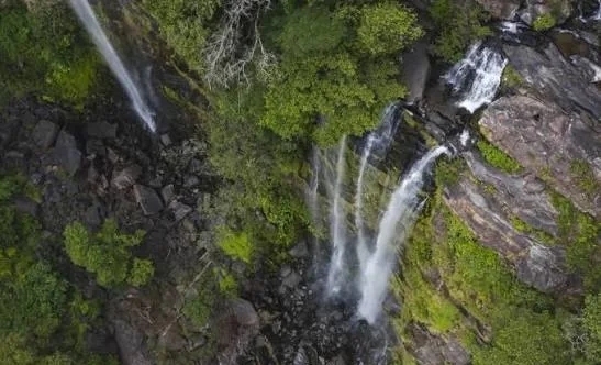
The park's visitor network is spread among local communities. Ban Thongxam operates the Houay Hok trails through forest and stream caves; Ban Nongboua offers the walk to Tad Songsou waterfall; Ban Nongseng is used for guided macaque watching at Pha Koud; Ban Nong Ping and Ban Pakphanang connect visitors with the Xe Bang Fai river-cave side. That structure matters because it changes how the trip should be planned. Choose the experience first, then the village base, guide and transport. Driving to a map pin called 'Hin Nam No National Park' without a route arranged is not the same thing as visiting the park.

WORLD HERITAGE
2025 changed the international status, not the need for restraint
UNESCO's 2025 decision made Hin Nam No part of the transboundary Phong Nha-Ke Bang and Hin Nam No World Heritage property on geological, ecological and biodiversity criteria. The combined property contains more than 220 kilometres of documented caves and subterranean waterways, while UNESCO records more than 1,500 vascular plant species and 536 vertebrate species in Hin Nam No itself. The designation raises the profile of the park, but UNESCO also explicitly warns that future tourism must remain within the ecological carrying capacity of the property. More visitors should not mean freer access everywhere.
COMMUNITY GUIDES
Local guiding is part of the conservation model
Hin Nam No's village-guided routes are not an optional layer added for convenience. The park has developed through collaborative management with surrounding communities, and village guides, rangers and local committees have long been part of protecting caves, forest and wildlife. On the Houay Hok Trail, for example, the local guide fee includes a contribution shared with the village for forest protection. The park's own visitor guidance requires local guides for village walks and caves and asks visitors to stay on used paths, leave plants and cave material untouched and keep noise down around wildlife. Paying the local system is part of how the visit is supposed to work.
FIELD NOTE · BEFORE YOU LEAVE
Build the trip around season, guide and daylight
The remoteness is real. Hin Nam No's visitor guidance closes the Ban Thongxam treks between June and October because of road conditions and stream volume, while some shorter village experiences may still operate in the wet season. Unexploded ordnance remains another reason to stay on used paths and follow local guidance. Carry cash, water, food backup, a working torch for cave routes and enough fuel for the road stages. Confirm your village guide and overnight plan before committing to the final approach rather than assuming services will be available on arrival.
QUESTIONS BEFORE GOING
Hin Nam No National Park,without the guesswork
Five things worth clearing up before you go.
Is Hin Nam No National Park a UNESCO World Heritage Site?
Yes. In July 2025 UNESCO approved the extension of Phong Nha-Ke Bang in Viet Nam to include Hin Nam No in Lao PDR. The two parks now form one transboundary Natural World Heritage property.
Can you visit Hin Nam No as a day trip from Thakhek?
A single long day is not the best way to experience the park because the useful visitor routes begin far east of Thakhek in Boualapha District. Plan at least an overnight, and preferably two to four days if you want a proper village-guided trek or more than one site.
Do you need a guide in Hin Nam No?
For the park's village walks and cave routes, follow the official guidance and use a local village guide. The guiding system is tied directly to safety, local knowledge and community conservation funding.
What can you do in Hin Nam No besides Xe Bang Fai Cave?
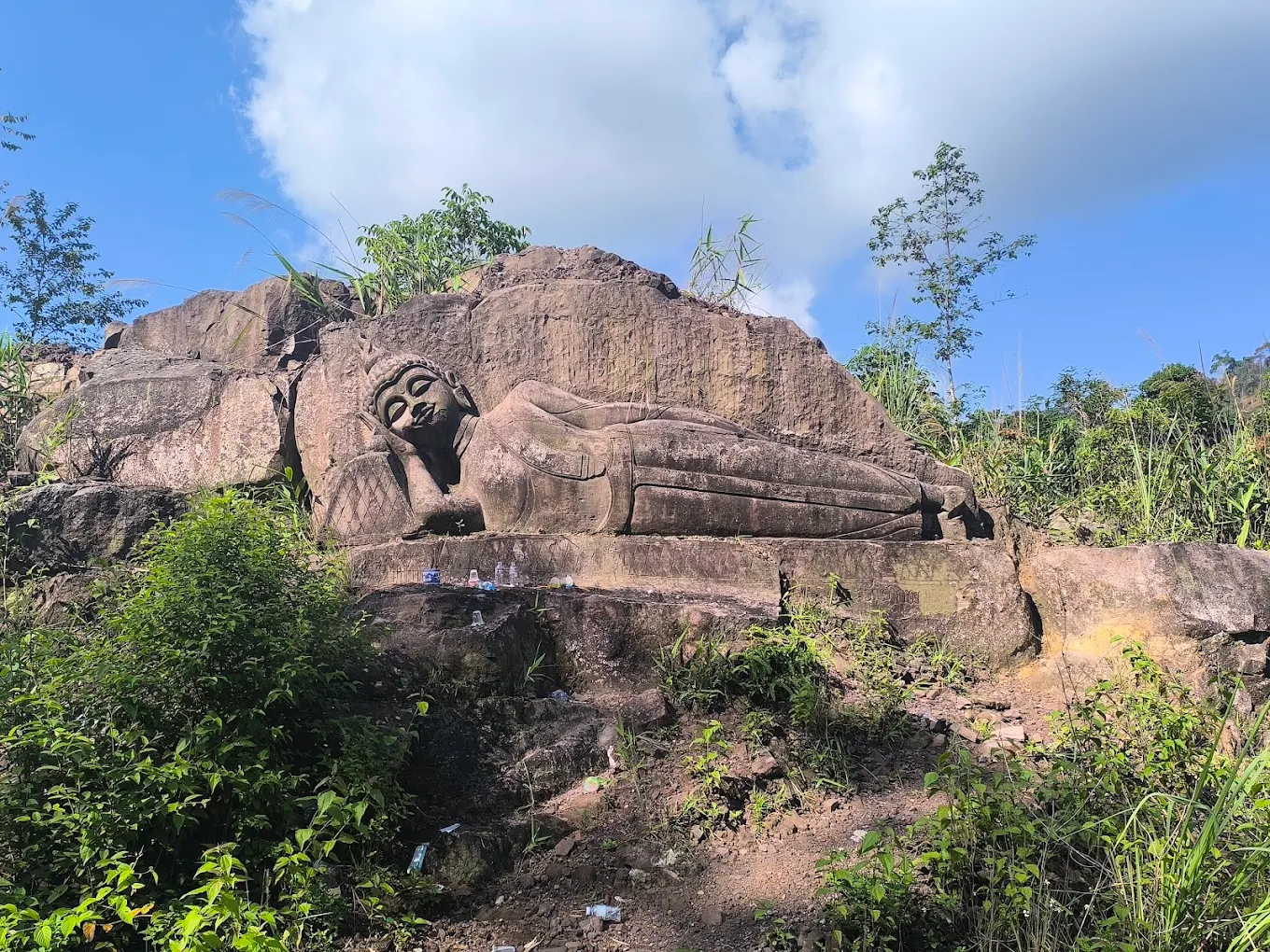
Official visitor routes include the Houay Hok short and long trails from Ban Thongxam, Tad Songsou waterfall from Ban Nongboua, macaque watching at Pha Koud from Ban Nongseng and historical routes connected with the Ho Chi Minh Trail, in addition to the Xe Bang Fai side.
What is the best season for Hin Nam No?
The dry season gives the broadest access. The official park site says Ban Thongxam treks close between June and October because of road conditions and stream volume, although some shorter routes from other villages may still be arranged in the wet season.
PLAN YOUR VISIT
Hin Nam No National Park,at a glance
The practical details worth keeping close before you go.
World Heritage status
UNESCO Natural World Heritage · since 2025
Hin Nam No was added in July 2025 to the existing Phong Nha-Ke Bang World Heritage property, creating a transboundary natural site shared by Lao PDR and Viet Nam.
Park size
94,121 hectares
UNESCO and Lao Parks both publish 94,121 hectares for Hin Nam No National Park in Boualapha District, Khammouane Province.
How visits work
Village guide + route-specific access
There is no single park circuit. The official Hin Nam No visitor site directs travellers to different guardian villages for treks, wildlife watching, waterfalls, boats and cave visits.
Time needed
2–4 days from Thakhek
Hin Nam No's own suggested itinerary uses four days from Thakhek and combines several villages and the Xe Bang Fai side. A shorter trip is possible by choosing one route, but travel time remains substantial.
Season
Dry season gives the widest access
Ban Thongxam's Houay Hok treks are closed from June through October because of road conditions and stream volume. Some short treks from other villages may still operate in the wet season, so confirm locally.
Safety & conduct
Stay on used paths · local guides for caves and village routes
The park warns that unexploded ordnance remains in the area. Its visitor rules also require local guides, ask visitors not to remove plants or cave material and emphasize low noise around wildlife.
KEEP IT IN YOUR ATLAS
Save Hin Nam No National Park for the road.
Keep this field note close. Add it to My Atlas now, or open the map when you are ready to work out the route.

Keep exploring Thakhek.






Field note method. Wikipedia is used as a research starting point for history and geography when a relevant article exists. Facts are checked against official, local or specialist sources where possible. Independent travel blogs and field reports are used to identify practical questions, recurring observations and traveller perspective; their wording is not copied.
Sources & photo licences
Research sources
Photo licences
- GIZ ProFEB · Nomination File · Attribution · NoDerivatives ↗
- Ryan Deboodt · Nomination File · Attribution · NoDerivatives ↗
- Ryan Deboodt · Nomination File · Attribution · NoDerivatives ↗
- Felix Stahlberg · CC BY 2.0 ↗
- Prince Roy · CC BY 2.0 ↗
- Phó Nháy · Public domain ↗
- Busy · CC BY-SA 3.0 ↗
- GIZ ProFEB / Lucas Wahl · Attribution · NoDerivatives ↗
- User-supplied photo · User-supplied
- User-supplied photo · User-supplied
- User-supplied photo · User-supplied
- Aleksey Gnilenkov · CC BY 2.0 ↗
- Aleksey Gnilenkov · CC BY 2.0 ↗
- chalongrat hantragul · CC BY 3.0 ↗
- Adriaan Castermans · See Wikimedia Commons file page ↗
- Aleksey Gnilenkov · CC BY 2.0 ↗
- User-supplied photo · User-supplied
- User-supplied photo · User-supplied
- User-supplied photo · User-supplied
- BacLuong · CC BY-SA 4.0 ↗
- Tango7174 · CC BY-SA 4.0 ↗