
WATERFALL HIKE · TAD LO
Tad Soung Waterfall
Tad Soung Tad Suong Tad Sung
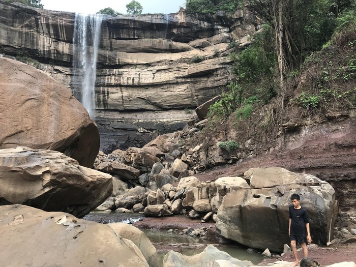
Tad Soung is the half-day waterfall excursion beyond the village: a rural approach through fields and settlements leads to a high Xe Set escarpment, a lower viewpoint and a broad panorama from above.
- 01 Follow the rural road from Tad Lo
- 02 Reach the lower falls
- 03 Climb the renovated trail or continue by road
- 04 Read the panorama even when the flow is low
Come for the landscape as much as the water. The upstream dam and season can change the waterfall dramatically, but the high escarpment and valley view remain the reason to give Tad Soung a half day.
FIELD NOTES
THE QUICK READ
Tad Soung Waterfall / Laos
TIME
HALF DAY
allow time for lower and upper access
ROUTE
≈4 KM TO LOWER FALLS
then 80–100 m trail ascent or road access to the top
BUDGET
FREE WATERFALL
motorbike parking normally about 10K KIP
BEST FOR
PANORAMA + RURAL HIKE
fields · villages · high escarpment · seasonal flow
THE APPROACH
The waterfall starts in the rural landscape
Tad Soung is the point where the three Tad Lo waterfalls stop feeling like one village walk. Current locally checked guidance places the lower falls about four kilometres by road from the Tad Lo Tourism Office, with the route moving through fields and settlements before the escarpment comes into view. That journey is part of the outing. Wikimedia photographs taken between Tad Lo and Tad Soung show cultivated fields rather than a tourist corridor, and the current waterfall guide describes Tad Soung as a genuine half-day rural excursion. Walk or ride slowly, stay on the obvious route and treat the villages and farmland as lived landscape rather than scenery arranged for visitors.
THE PANORAMA
The view survives when the waterfall shrinks
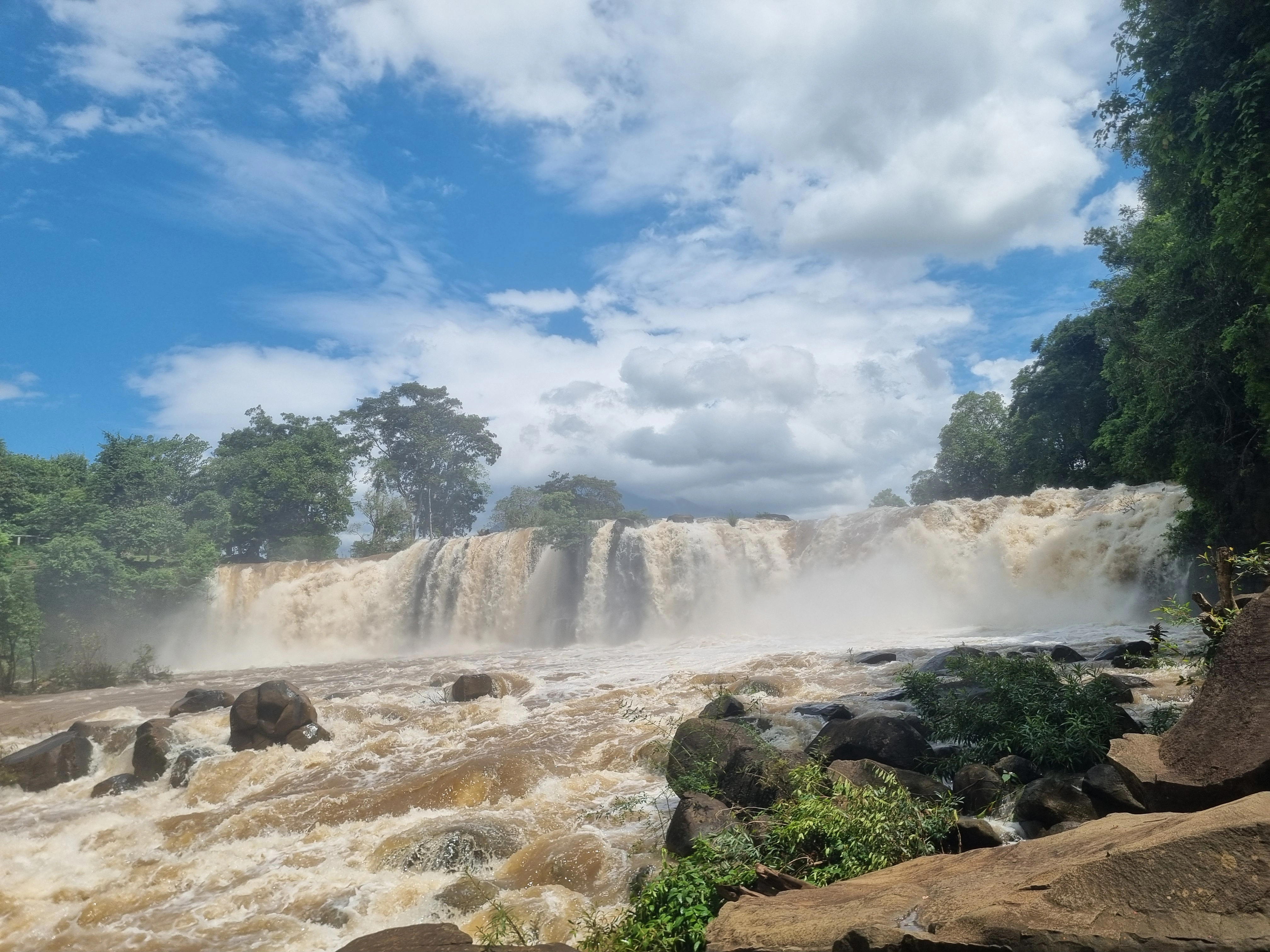
Older Lao reporting singled out Tad Soung for the broad rolling-landscape view from the top, and that remains the best way to understand why the excursion works in every season. Current Visit Tad Lo guidance adds an important modern detail: an upstream dam controls the flow, so the waterfall can change dramatically and may carry little or no water in the dry season. Wet weather can produce a far more impressive drop, but the panorama does not depend on a perfect curtain of water. Come for the height, valley and rural scale first; treat strong flow as a seasonal bonus rather than a promise.


THE TWO ROUTES
Choose the climb or the road to the top
The current locally checked route gives Tad Soung two useful versions. Walk or ride about four kilometres from Tad Lo to the lower falls, then take the renovated trail between the lower and upper sections; the climb gains roughly 80–100 metres and needs reasonable fitness. If that ascent is not appealing, the alternative is to continue about four kilometres farther by road to the upper access. Neither route is automatically better. The trail makes the vertical landscape physical, while the road preserves energy for the viewpoint. Decide according to weather, footwear and how much walking you actually want in the day.
THE SEASON
Do not confuse dry with disappointing
Tad Soung is unusually sensitive to both season and water management. Current local guidance says the upstream dam controls flow, and the dry season can leave little or no water over the escarpment. Older Lao reporting made the same practical point from a visitor perspective: the wet-season waterfall can be spectacular, while the dry-season reason to come is the view from the top. That makes expectation management part of the activity. Check the recent flow if the waterfall itself is your priority; otherwise plan the half day around the rural walk and panorama and let the water be whatever it is.
FIELD NOTE · BEFORE YOU LEAVE
The upper edge is not a viewpoint to improvise
The cliff and high ground are the reason Tad Soung feels more adventurous than Tad Hang or Tad Lo, but they also remove the margin for careless shortcuts. Use the renovated trail or current road access, keep away from exposed edges, and be especially conservative after rain when rock and soil are wet. Leave enough daylight for the return through rural roads and villages. If the trail is in poor condition, take the road or turn back; there is no prize for forcing the climb.
QUESTIONS BEFORE GOING
Tad Soung Waterfall,without the guesswork
Five things worth clearing up before you go.
How far is Tad Soung Waterfall from Tad Lo?
Current locally checked guidance places the lower falls about four kilometres by road from the Tad Lo Tourism Office. From there you can climb the renovated trail to the upper section or continue roughly four kilometres farther by road to the upper access.
Can you walk to Tad Soung without a motorbike?
Yes. Visit Tad Lo explicitly lists Tad Soung as walkable. The full outing is a half day and the climb between lower and upper sections gains around 80–100 metres, so reasonable fitness, water and suitable footwear help.
Is Tad Soung Waterfall free?
The waterfall itself is currently listed free. Motorbike parking is normally around 10,000 kip; in low season the arrangement can be informal, so carry small cash and follow the current local setup.
Does Tad Soung have water in the dry season?
Not necessarily. Current local guidance says an upstream dam controls the flow, so the waterfall can have little or no visible water in the dry season. The upper panorama can still make the excursion worthwhile even when the drop is dry.
Is the climb to the top of Tad Soung difficult or dangerous?
The renovated lower-to-upper trail is rated as part of a moderate outing and gains roughly 80–100 metres. The main caution is the high escarpment and slippery conditions after rain: use the current trail, wear shoes with grip and stay away from exposed edges.
PLAN YOUR VISIT
Tad Soung Waterfall,at a glance
The practical details worth keeping close before you go.
Lower access
About 4 km by road from Tad Lo Tourism Office
Current locally checked guidance places the lower falls roughly four kilometres from the Tourism Office. The route is walkable, though a motorbike makes the half-day outing easier in heat or rain.
Upper access
Renovated trail or roughly 4 km farther by road
From the lower falls, the current trail climbs to the upper section with around 80–100 metres of ascent. Travellers who do not want the climb can continue approximately four kilometres farther by road to the upper access.
Time & difficulty
Half day · moderate
Allow enough time for the rural approach, lower viewpoint and upper panorama without rushing. Reasonable fitness is useful on the climb, and wet-season trail conditions can make the outing harder.
Cost
Waterfall free · motorbike parking normally about 10K KIP
Visit Tad Lo currently lists the waterfall itself as free. Motorbike parking is normally around 10,000 kip; in quiet periods local arrangements can be informal, so carry small cash.
Season & flow
Dam-controlled · highly variable
An upstream dam controls the flow. The dry season can leave little or no visible waterfall while preserving the panorama; rainy conditions can produce much stronger water but also rougher lower access and trail conditions.
Safety
High escarpment · wet trail · no edge shortcuts
Use caution around the upper cliff and on the climb. Wear shoes with grip, check conditions after rain and do not move toward exposed edges or strong water just to improve the view or photograph.
KEEP IT IN YOUR ATLAS
Save Tad Soung Waterfall for the road.
Keep this field note close. Add it to My Atlas now, or open the map when you are ready to work out the route.

Keep exploring Tad Lo.






Field note method. Wikipedia is used as a research starting point for history and geography when a relevant article exists. Facts are checked against official, local or specialist sources where possible. Independent travel blogs and field reports are used to identify practical questions, recurring observations and traveller perspective; their wording is not copied.
Sources & photo licences
Research sources
Photo licences
- Visit Tad Lo partner media · Used with owner permission; attribution and link to Visit Tad Lo required ↗
- Christophe95 · CC BY-SA 4.0 ↗
- Christophe95 · CC BY-SA 4.0 ↗
- Basile Morin · CC BY-SA 4.0 ↗
- User-supplied photo · User-supplied
- Visit Tad Lo partner media · Used with owner permission; attribution and link to Visit Tad Lo required ↗
- Visit Tad Lo partner media · Used with owner permission; attribution and link to Visit Tad Lo required ↗
- Visit Tad Lo partner media · Used with owner permission; attribution and link to Visit Tad Lo required ↗
- Visit Tad Lo partner media · Used with owner permission; attribution and link to Visit Tad Lo required ↗
- Visit Tad Lo partner media · Used with owner permission; attribution and link to Visit Tad Lo required ↗
- Visit Tad Lo partner media · Used with owner permission; attribution and link to Visit Tad Lo required ↗
- Visit Tad Lo partner media · Used with owner permission; attribution and link to Visit Tad Lo required ↗
- Pierre André Leclercq · CC BY-SA 4.0 ↗
- Basile Morin · CC BY-SA 4.0 ↗
- Basile Morin · CC BY-SA 4.0 ↗