
WATERFALL NOTE · TAD LO
Tad Hang Waterfall
Tad Hang Tat Hang Xe Set waterfall
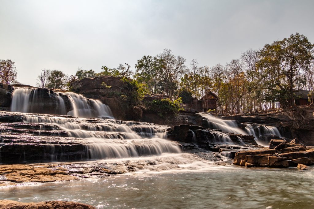
Tad Hang is the easiest first waterfall from Tad Lo: a broad tiered cascade on the Xe Set River, close enough to reach on foot and woven into the village’s everyday riverside life.
- 01 Walk out from Tad Lo
- 02 Start at the bridge and broad cascade
- 03 Follow the Xe Set upstream
- 04 Let the water level decide the swim
Use Tad Hang as the easy introduction to the river. Look first, read the current, then decide whether the day is for swimming or simply sitting beside the falls.

FIELD NOTES
THE QUICK READ
Tad Hang Waterfall / Laos
TIME
1–2 HOURS
easy to shorten or linger longer
ROUTE
WALK FROM TAD LO
about 700 m by road from the Tourism Office
BUDGET
CURRENTLY FREE
reconfirm if site arrangements change
BEST FOR
EASY FIRST WATERFALL
river views · village walk · cautious swim
THE FIRST FALL
Start where Tad Lo meets the Xe Set
Tad Hang is the easiest of Tad Lo’s three waterfall experiences to fold into village life. Salavan tourism material describes a broad cascade roughly 30 metres wide dropping about 10 metres over tiered rock, while the current local guide places it about 700 metres by road from the Tad Lo Tourism Office. That proximity changes the feel of the visit: you do not need a motorbike or a separate excursion plan. Walk out through the village, stop around the bridge and riverbank, and let the waterfall become part of an ordinary Tad Lo afternoon rather than a destination you have to conquer.
THE RIVER
Read Tad Hang as one chapter of the Xe Set
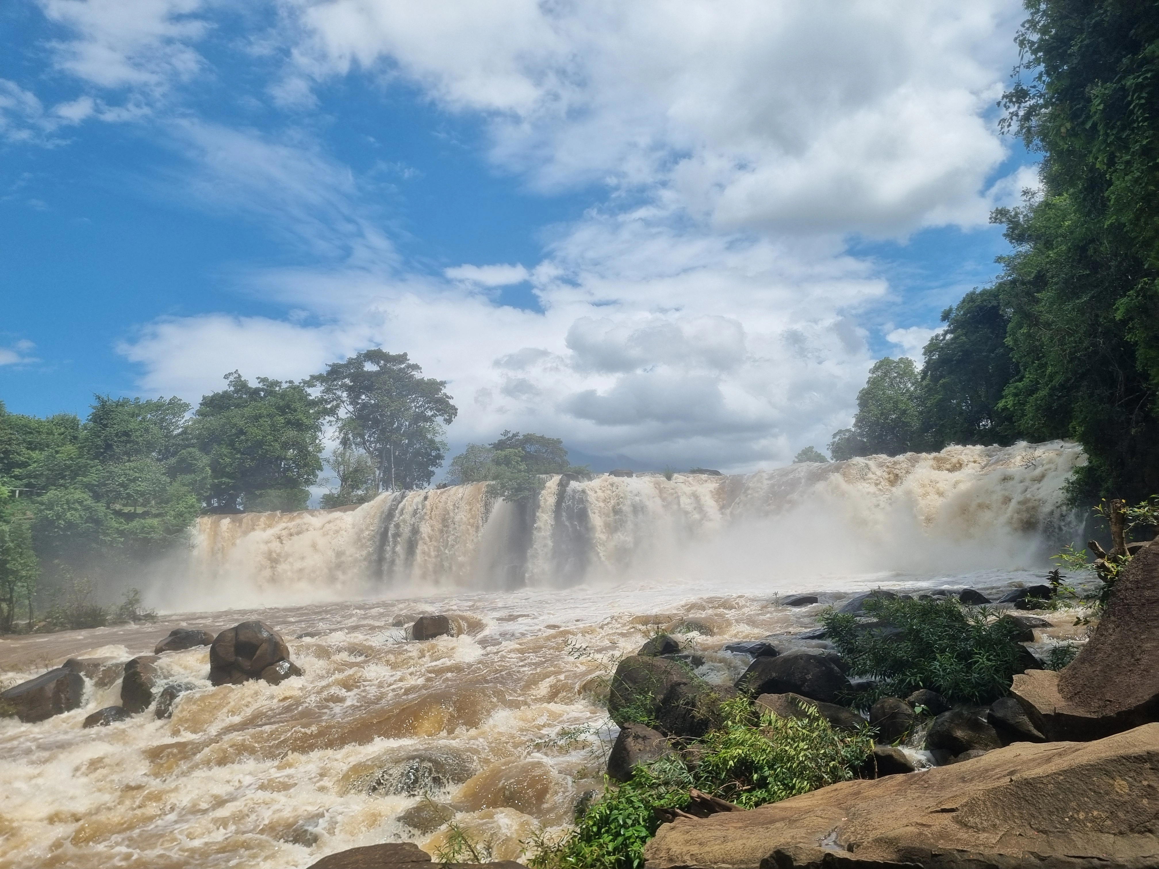
Tad Hang makes more sense when you remember that it is not an isolated waterfall. The Xe Set comes down from the Bolaven Plateau through Tad Soung upstream, then continues through Tad Lo and Tad Hang around the village. Tad Lo lies roughly 500 metres upstream from Tad Hang in long-standing Salavan tourism descriptions, so the two lower falls naturally belong to the same slow walk. Water level changes the character of all three: lower flow exposes more rock and may create calmer edges, while rain can quickly turn the river heavier and faster.

THE SITE
A village waterfall that is still evolving
Tad Hang has been part of Tad Lo tourism for decades rather than appearing with the recent Bolaven boom. KPL reported that the Tad Loh–Tad Hang site had been open to the public since 1986, while a new tourism-development project was authorised in 2023. Phase one, running through 2026, focuses on renovation and basic infrastructure; later phases are intended to add more visitor services. That means older guidebook descriptions and today’s layout may not match perfectly. Use the waterfall itself as the constant and treat facilities, access arrangements and any fees as details to verify on the day.
THE PAUSE
Do not turn the easiest waterfall into a checklist stop
Because Tad Hang is so close to accommodation, food and the village, it is easy to give it ten minutes and move on. The better use of the place is slower: cross or stand near the bridge, watch how the river breaks over the broad rock ledges, then continue upstream only when you feel like moving again. If the water is unsuitable for swimming, nothing important has been lost. Tad Hang still works as a riverbank pause and as the opening chapter to understanding how the Xe Set shapes Tad Lo.
FIELD NOTE · BEFORE YOU LEAVE
Let today’s river overrule yesterday’s advice
The useful safety rule at Tad Hang is simple: conditions are dynamic. A pool or river edge that looked calm in the dry season can behave very differently after heavy rain, and local advice from someone looking at the river today is more useful than a photo, review or saved itinerary. If the current looks strong, stay on the bank and enjoy the waterfall as a viewpoint. If locals say a calmer area is suitable, enter gradually and remain close to shore. The waterfall is close enough to the village that there is no reason to force a swim.
QUESTIONS BEFORE GOING
Tad Hang Waterfall,without the guesswork
Five things worth clearing up before you go.
How far is Tad Hang Waterfall from Tad Lo?
The current locally maintained Tad Lo guide places Tad Hang about 700 metres by road from the Tad Lo Tourism Office. It is an easy walk from the village and does not require a motorbike.
Is Tad Hang Waterfall free to visit?
Visit Tad Lo currently lists Tad Hang as free. The Tad Loh–Tad Hang site is also undergoing a multi-phase tourism-development programme, so follow current local signs and reconfirm if entrance arrangements change.
Can you swim at Tad Hang Waterfall?
Swimming can be possible when conditions are suitable, especially around calmer edges, but it is not a permanent guarantee. Rain can strengthen the Xe Set quickly, so check local advice on the day and stay out when the current looks strong.
How long do you need at Tad Hang Waterfall?
One to two hours is enough for an unhurried waterfall stop. Allow longer if you combine Tad Hang with Tad Lo Waterfall, roughly 500 metres upstream, or stop for food beside the river.
What is the difference between Tad Hang and Tad Lo Waterfall?
Tad Hang is the lower, broad tiered cascade closest to the village and is usually the easiest first stop. Tad Lo is slightly farther upstream and forms a separate waterfall on the same Xe Set River; the two work naturally as one walking outing.
PLAN YOUR VISIT
Tad Hang Waterfall,at a glance
The practical details worth keeping close before you go.
From Tad Lo
About 700 m by road from the Tourism Office
Visit Tad Lo currently places Tad Hang roughly 700 metres by road from the Tourism Office. It is one of the easiest local activities to do without a motorbike and fits naturally into a village walk.
Time needed
1–2 hours is plenty for an unhurried stop
The waterfall itself is close to the village, so most travellers do not need a half day. Allow longer only if you combine it with Tad Lo Waterfall, stop for food nearby or spend time beside the river.
Entrance
Currently listed free · reconfirm locally
The current locally maintained Tad Lo guide lists Tad Hang as free. KPL has also reported an ongoing multi-phase redevelopment of the Tad Loh–Tad Hang tourism site, so entrance arrangements can evolve; follow the current signs or local information when you arrive.
Swimming
Possible only when the day’s water conditions are suitable
Local guidance treats swimming as condition-dependent rather than permanently safe. Lower dry-season flow can make some edges calmer, while rain can strengthen currents quickly. Ask locally and stay out when the river looks fast or recent rain has changed it.
Best time
Morning or late afternoon
The walk is short enough to fit the cooler ends of the day, when the riverbank is also more comfortable for sitting. Seasonal water level matters more than chasing a single ideal hour.
Nearby
Tad Lo Waterfall is roughly 500 m upstream
Older Salavan tourism material links Tad Hang to Tad Lo by riverside paths and places Tad Lo about 500 metres upstream. Combining the two lower falls is the most natural way to turn Tad Hang into a longer village outing.
KEEP IT IN YOUR ATLAS
Save Tad Hang Waterfall for the road.
Keep this field note close. Add it to My Atlas now, or open the map when you are ready to work out the route.

Keep exploring Tad Lo.





Field note method. Wikipedia is used as a research starting point for history and geography when a relevant article exists. Facts are checked against official, local or specialist sources where possible. Independent travel blogs and field reports are used to identify practical questions, recurring observations and traveller perspective; their wording is not copied.
Sources & photo licences
Research sources
Photo licences
- Basile Morin · CC BY-SA 4.0 ↗
- Basile Morin · CC BY-SA 4.0 ↗
- Visit Tad Lo partner media · Used with owner permission; attribution and link to Visit Tad Lo required ↗
- User-supplied photo · User-supplied
- Visit Tad Lo partner media · Used with owner permission; attribution and link to Visit Tad Lo required ↗
- Visit Tad Lo partner media · Used with owner permission; attribution and link to Visit Tad Lo required ↗
- Visit Tad Lo partner media · Used with owner permission; attribution and link to Visit Tad Lo required ↗
- Visit Tad Lo partner media · Used with owner permission; attribution and link to Visit Tad Lo required ↗
- Visit Tad Lo partner media · Used with owner permission; attribution and link to Visit Tad Lo required ↗
- Visit Tad Lo partner media · Used with owner permission; attribution and link to Visit Tad Lo required ↗
- Visit Tad Lo partner media · Used with owner permission; attribution and link to Visit Tad Lo required ↗
- Visit Tad Lo partner media · Used with owner permission; attribution and link to Visit Tad Lo required ↗
- Christophe95 · CC BY-SA 4.0 ↗
- Pierre André Leclercq · CC BY-SA 4.0 ↗
- Basile Morin · CC BY-SA 4.0 ↗
- Basile Morin · CC BY-SA 4.0 ↗