
SELF-GUIDED WALK · TAD LO
Tad Lo Riverside & Village Walk
Free 1–2 hours On foot
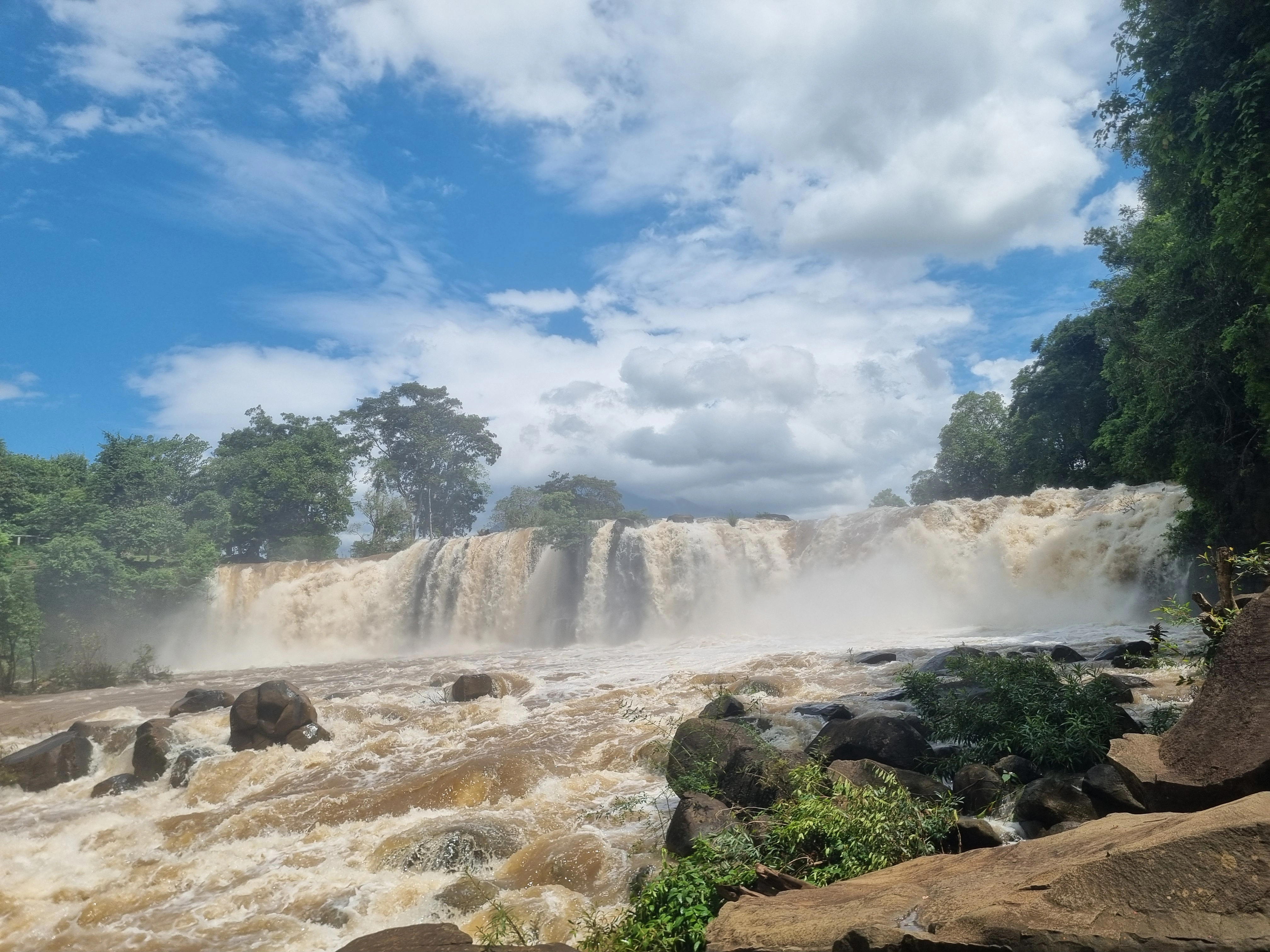
Walk Tad Lo without turning the village into a checklist: follow the river, drift between small lanes and everyday village edges, pause around the wooden footbridge when it is present, and let the waterfalls sit naturally inside the landscape rather than treating them as separate stops.
- 01 Start in Tad Lo village
- 02 Follow the river at an easy pace
- 03 Use public lanes and footpaths
- 04 Loop back through the village
There is no official circuit to complete. The point is to notice the river, houses, gardens, bridges and everyday movement between the larger attractions.

FIELD NOTES
THE QUICK READ
Tad Lo Riverside & Village Walk / Laos
TIME
1–2 HOURS
Longer if you stop for food, coffee or the waterfalls
ROUTE
ON FOOT IN TAD LO
Flexible self-guided loop · no formal marked circuit
BUDGET
FREE
Food, drinks and other activities are optional extras
BEST FOR
RIVER + VILLAGE LIFE
Slow mornings · photography · no-motorbike days
THE WALK
Follow the river, not a checklist
Visit Tad Lo explicitly presents the village as a place that works on foot: walk through the village, enjoy the river and connect nearby waterfalls, food and small activities without needing a motorbike. This Field Note turns that idea into a simple self-guided walk rather than pretending there is one official marked trail. Start in the centre, drift toward the river, use public lanes and footpaths, and let the wooden bridges, houses, gardens and daily village life set the pace. Tad Lo and Tad Hang can naturally extend the walk, but they do not have to become timed objectives.

QUESTIONS BEFORE GOING
Tad Lo Riverside & Village Walk,without the guesswork
Five things worth clearing up before you go.
Is there an official Tad Lo Riverside & Village Walk route?
No fixed official circuit is published. This Atlas Field Note is a flexible self-guided way to combine the village, river and public paths using the walkable character described by Visit Tad Lo.
How long should you allow for the Tad Lo village walk?
Around one to two hours works well for the walk itself. Give it longer if you add Tad Hang, Tad Lo Waterfall, food or coffee along the way.
Is the riverside village walk free?
Yes. The self-guided walk through public village lanes and along the river is free. Any food, drinks or separate paid activity you choose to add are extra.
What is the best time for the walk?
Early morning or late afternoon is the easiest rhythm: temperatures are usually more comfortable and the village light is softer. Keep the walk in daylight, especially if rain has made paths slippery.
Can you cross the wooden footbridge shown in Tad Lo photos?
Do not assume it is a permanent crossing. Wikimedia documents a temporary wooden footbridge on the Tad Lo river in 2019; only use a bridge if it is actually present, open and clearly safe when you visit.
PLAN YOUR VISIT
Tad Lo Riverside & Village Walk,at a glance
The practical details worth keeping close before you go.
Start
Tad Lo village centre · entirely on foot
Visit Tad Lo describes the village, river, nearby waterfalls, food and several activities as walkable without personal transport. There is no need to arrange a vehicle for this Field Note.
Time
About 1–2 hours
That is enough for an easy village-and-river wander. Add more time if you stop at Tad Hang, Tad Lo Waterfall, a restaurant or a coffee spot.
Cost
Free self-guided walk
Walking the public village lanes and river edge does not require an activity ticket. Food, drinks and any separate attraction or service remain optional.
Conditions
Daylight · river level and rain matter
Use public paths and only use a footbridge if it is present, open and clearly safe on the day. Temporary river crossings can change with the season, and wet ground can become slippery after rain.
KEEP IT IN YOUR ATLAS
Save Tad Lo Riverside & Village Walk for the road.
Keep this field note close. Add it to My Atlas now, or open the map when you are ready to work out the route.

Keep exploring Tad Lo.






Field note method. Wikipedia is used as a research starting point for history and geography when a relevant article exists. Facts are checked against official, local or specialist sources where possible. Independent travel blogs and field reports are used to identify practical questions, recurring observations and traveller perspective; their wording is not copied.
Sources & photo licences
Research sources
Photo licences
- Basile Morin · CC BY-SA 4.0 ↗
- Christophe95 · CC BY-SA 4.0 ↗
- Basile Morin · CC BY-SA 4.0 ↗
- User-supplied photo · User-supplied
- Visit Tad Lo partner media · Used with owner permission; attribution and link to Visit Tad Lo required ↗
- Visit Tad Lo partner media · Used with owner permission; attribution and link to Visit Tad Lo required ↗
- Visit Tad Lo partner media · Used with owner permission; attribution and link to Visit Tad Lo required ↗
- Visit Tad Lo partner media · Used with owner permission; attribution and link to Visit Tad Lo required ↗
- Visit Tad Lo partner media · Used with owner permission; attribution and link to Visit Tad Lo required ↗
- Visit Tad Lo partner media · Used with owner permission; attribution and link to Visit Tad Lo required ↗
- Visit Tad Lo partner media · Used with owner permission; attribution and link to Visit Tad Lo required ↗
- Visit Tad Lo partner media · Used with owner permission; attribution and link to Visit Tad Lo required ↗
- Christophe95 · CC BY-SA 4.0 ↗
- Pierre André Leclercq · CC BY-SA 4.0 ↗
- Basile Morin · CC BY-SA 4.0 ↗