
VILLAGE WATERFALL · TAD LO
Tad Lo Waterfall
Tad Lo Tad Lor Tad Loh
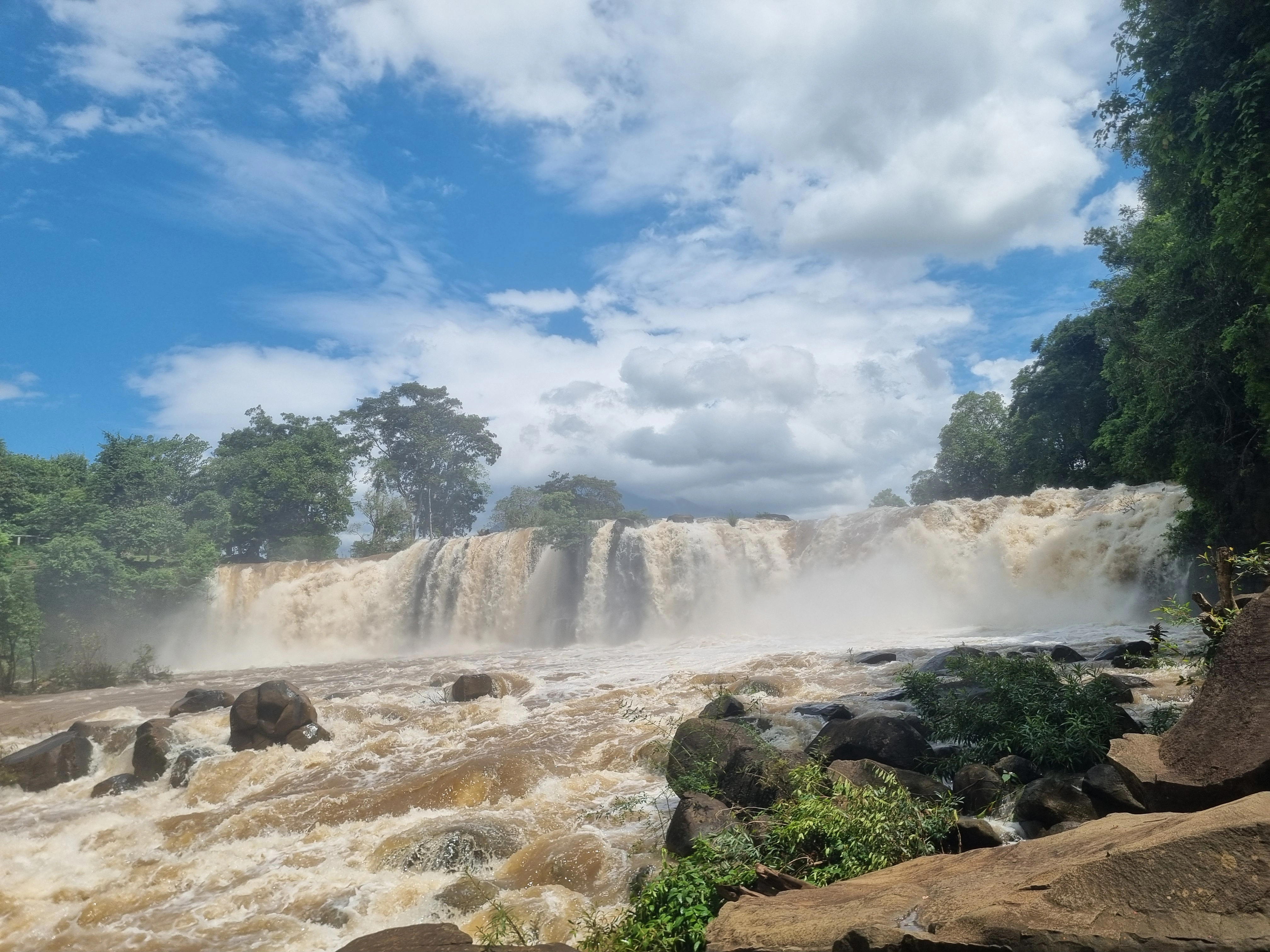
Tad Lo is the village’s namesake fall and Salavanh’s signature waterfall: a broad, green-framed Xe Set cascade that works best as part of a slow riverside walk with Tad Hang.
- 01 Walk upstream through the village
- 02 Find the broad semi-horseshoe cascade
- 03 Pair the fall with Tad Hang
- 04 Let current conditions decide the swim
Do not turn the namesake waterfall into a standalone transfer. Walk it with Tad Hang and let the river paths connect the two.
FIELD NOTES
THE QUICK READ
Tad Lo Waterfall / Laos
TIME
1–2 HOURS
longer when paired with Tad Hang
ROUTE
WALKABLE FROM TAD LO
about 1.1 km by road from the Tourism Office
BUDGET
CURRENTLY FREE
public access listed free · private-side charges can differ
BEST FOR
THE NAMESAKE FALL
village walk · Xe Set · slow afternoon
THE SHAPE
The fall appears through the trees
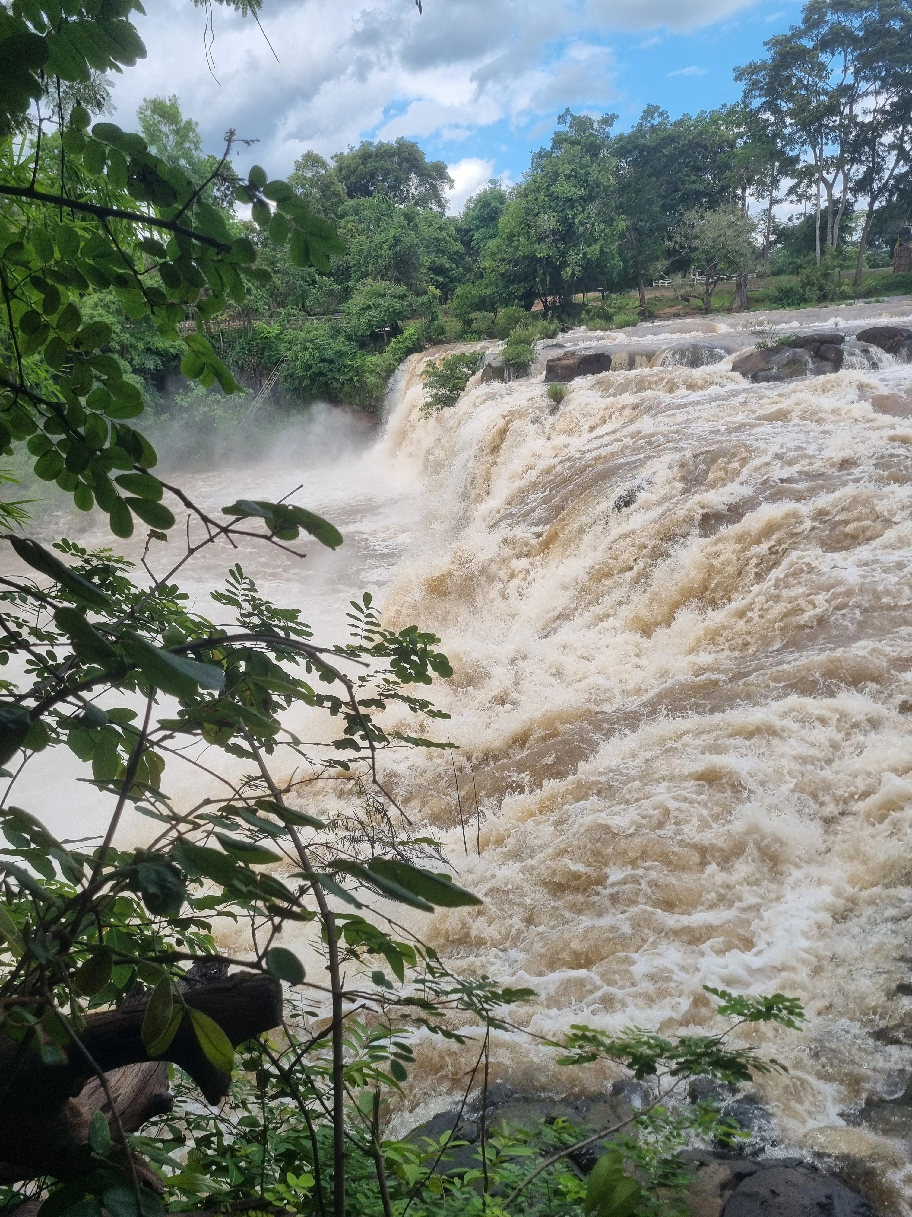
Long-standing Salavanh tourism material describes Tad Lo as the slightly taller partner to Tad Hang, with a broad semi-horseshoe shape divided by a projecting rock and enough spray to hang mist over the base when the river is carrying good water. The approach matters because the waterfall is not presented as one giant roadside reveal: paths through the trees and the river edge gradually open the view. Current Visit Tad Lo information still keeps the site firmly inside village scale, about 1.1 kilometres by road from the Tourism Office and easy enough to reach on foot. That combination — substantial waterfall, ordinary village access — is what gives Tad Lo its identity.
THE PAIR
Tad Lo and Tad Hang belong to one walk
Tad Lo sits upstream on the same Xe Set system as Tad Hang. Older provincial descriptions place the two roughly 500 metres apart along the river, while the current local guide continues to present both as easy, walkable village outings. Treating them as separate excursions makes the geography feel more complicated than it is. Start with whichever fall is closest to your accommodation, follow the river and village paths, then stop when the heat, light or water suggests stopping. The two falls work because the walk between them keeps the river in view and turns sightseeing into a slower reading of the village.

THE LANDMARK
Why Tad Lo became Salavanh’s signature waterfall
Official Tourism Laos presents Tad Lo as the best-known or primary tourism attraction in Salavanh Province, and the reason is larger than the waterfall alone. The Xe Set cascade sits inside a village that grew into a practical travel base, with guesthouses, resorts, food and paths close enough that the landscape never feels separated from daily life. You can walk to the falls, keep going to Tad Hang, eat nearby and still be back at your room without organising a vehicle. That accessibility is not a weakness; it is what turned Tad Lo from a remote natural sight into the place most travellers use to read this part of Salavanh and the Bolaven Plateau at a slower scale.
THE CHANGE
The visitor site is still being reshaped
KPL reported that a new Tad Loh–Tad Hang tourism-development project was authorised in 2023, with a first phase running through 2026 and later expansion planned through 2030. Recent work has included renovated visitor infrastructure and reopening improvements, so older descriptions of paths, stairs, facilities or access points should not be treated as a precise map of the site today. The useful approach is to trust the current river and current signs first. Public access is presently listed free by Visit Tad Lo, but any private-side or restaurant-linked access arrangement should be understood as a separate local charge rather than automatically described as the waterfall entrance fee.
FIELD NOTE · BEFORE YOU LEAVE
The river is still more important than the infrastructure
Tad Lo is easy to reach and increasingly developed, but the Xe Set still decides what kind of visit you are having. Dry-season water can expose more rock and calmer edges; rain can turn the same sections heavier and faster. Read the river before considering a swim, ask locally after strong rain and do not use a calm-looking photograph from another season as evidence for today. The same applies to access: follow current paths and signs even when an older guide describes a different bank or staircase. The best plan is simple — walk from the village, pair Tad Lo with Tad Hang, and let present conditions decide how close to the water you go.
QUESTIONS BEFORE GOING
Tad Lo Waterfall,without the guesswork
Five things worth clearing up before you go.
How far is Tad Lo Waterfall from the village?
Visit Tad Lo currently places the waterfall about 1.1 kilometres by road from the Tourism Office. It is close enough to reach on foot through the village and works naturally as part of the same walk as Tad Hang.
Is Tad Lo Waterfall free to visit?
Current local guidance lists public access as free. If a private-side route, restaurant or other local service asks for a charge, treat that as a separate access arrangement rather than assuming it is the official waterfall entrance fee.
Can you swim at Tad Lo Waterfall?
Swimming is condition-dependent. Lower dry-season flow can create calmer edges, while rain can quickly increase current and make the river unsuitable. Check local advice on the day and skip swimming when the Xe Set looks strong.
What is the difference between Tad Lo and Tad Hang Waterfall?
Tad Lo is the village’s namesake waterfall upstream on the Xe Set and is described in older provincial tourism material as slightly taller and broader in shape. Tad Hang is the lower, easier first cascade. They are close enough to work best as one walking outing.
How long should you spend at Tad Lo Waterfall?
Allow about one to two hours for the waterfall itself. Give yourself longer if you are walking Tad Lo and Tad Hang together, stopping for food or simply spending time beside the river rather than treating each fall as a quick photo stop.
PLAN YOUR VISIT
Tad Lo Waterfall,at a glance
The practical details worth keeping close before you go.
From Tad Lo
About 1.1 km by road from the Tourism Office
Visit Tad Lo currently places the namesake waterfall about 1.1 kilometres by road from the Tourism Office. It is close enough to reach on foot through the village without turning the visit into a transport outing.
Time needed
1–2 hours · longer with Tad Hang
The waterfall works as a short standalone walk, but the better plan is to connect it with Tad Hang and leave enough room to stop beside the river rather than timing each fall separately.
Entrance
Public access currently listed free
The current local guide lists public access as free and notes that a private-side access or restaurant-linked charge, if operating, should be treated separately. Follow current signs and reconfirm any charge before assuming it is part of the waterfall entry.
Swimming
Condition-dependent · ask after rain
Dry-season flow can leave calmer areas, while wet-season rain makes the Xe Set stronger and faster. Treat swimming as optional and follow current local advice rather than relying on a permanent online label of safe or unsafe.
Best time
Morning or late afternoon
The cooler ends of the day suit the village walk and give more comfortable light around the river. Water level and recent rain matter more than a fixed ideal hour.
Pairing
Tad Hang lies roughly 500 m downstream
Older provincial tourism material places Tad Lo about 500 metres upstream from Tad Hang, and current local guidance still presents both as walkable village activities. Combine the two instead of arranging separate transfers.
KEEP IT IN YOUR ATLAS
Save Tad Lo Waterfall for the road.
Keep this field note close. Add it to My Atlas now, or open the map when you are ready to work out the route.

Keep exploring Tad Lo.






Field note method. Wikipedia is used as a research starting point for history and geography when a relevant article exists. Facts are checked against official, local or specialist sources where possible. Independent travel blogs and field reports are used to identify practical questions, recurring observations and traveller perspective; their wording is not copied.
Sources & photo licences
Research sources
Photo licences
- User-supplied photo · User-supplied
- Tango7174 · CC BY-SA 4.0 ↗
- User-supplied photo · User-supplied
- Basile Morin · CC BY-SA 4.0 ↗
- Visit Tad Lo partner media · Used with owner permission; attribution and link to Visit Tad Lo required ↗
- Visit Tad Lo partner media · Used with owner permission; attribution and link to Visit Tad Lo required ↗
- Visit Tad Lo partner media · Used with owner permission; attribution and link to Visit Tad Lo required ↗
- Visit Tad Lo partner media · Used with owner permission; attribution and link to Visit Tad Lo required ↗
- Visit Tad Lo partner media · Used with owner permission; attribution and link to Visit Tad Lo required ↗
- Visit Tad Lo partner media · Used with owner permission; attribution and link to Visit Tad Lo required ↗
- Visit Tad Lo partner media · Used with owner permission; attribution and link to Visit Tad Lo required ↗
- Visit Tad Lo partner media · Used with owner permission; attribution and link to Visit Tad Lo required ↗
- Christophe95 · CC BY-SA 4.0 ↗
- Pierre André Leclercq · CC BY-SA 4.0 ↗
- Basile Morin · CC BY-SA 4.0 ↗
- Basile Morin · CC BY-SA 4.0 ↗